Introducing Stratos Drones – Our Services
At Stratos Drones, we specialise in comprehensive drone surveys for various properties, including residential and commercial structures. Our state-of-the-art drones, equipped with high-resolution cameras, capture detailed images and video to accurately assess roof conditions. Our approach reduces safety risks associated with traditional manual inspections at great heights. Our drone surveys enhance safety, save time, and are cost-effective. Our experienced professionals meticulously analyse the collected data, facilitating early detection of issues like leaks, moisture damage, or structural problems. Timely repair and maintenance can save our clients from expensive, unexpected remedial works in the future.
Drone technology – how it has revolutionised the surveying industry
Drone technology has enabled professionals offer extensive drone services, to analyse the status of roofs safely and efficiently. Drones can capture aerial images with unprecedented precision, allowing surveyors to complete projects quickly, accurately, and cost-effectively. These machines are incredibly versatile – they can fly at great heights and traverse difficult terrains without putting a single human life at risk. With the help of drones, surveyors can now inspect even the most challenging roof structures and assess their condition without ever setting foot on it.
In addition to surveying roofs, drones can also be used to measure distances, determine elevations or examine other buildings in a given area. Drones are extremely versatile when it comes to surveying; they can capture data in a fraction of the time it would take to do so manually. Drones can also be equipped with specialised sensors that help surveyors collect data more accurately and identify any underlying problems before they become serious.
Different types of drone surveying for commercial and domestic customers
Drone surveying varies significantly in scope and application for commercial and domestic customers. For commercial clients, drones are often used for large-scale roof surveys or building inspections, mapping extensive areas of land for construction projects, and monitoring environmental changes or waste management in industrial areas. They are also invaluable for infrastructure inspections, where they can swiftly and safely assess the structural integrity of bridges, roads, or power lines, for example.
On the other hand, for domestic customers, drone surveys are typically utilised for smaller-scale projects such as home roof inspections, real estate photography, or even detecting heat loss in homes with thermal imaging capabilities. Regardless of the scale, drone surveys provide detailed, accurate, and timely data, enabling both commercial and domestic customers to make informed decisions about their properties.
Benefits of using drones for roof surveys instead of traditional methods
The primary advantage of using drones over traditional surveying methods is that they eliminate the need for manual inspection at great heights. This reduces safety risks and costs associated with labour-intensive operations, while also enabling surveyors to complete projects more quickly.
Drones are also much better equipped to capture detailed images and video compared to manual inspections.
Drones allow surveyors to collect a range of data that can be used for detailed analysis. This includes aerial imagery, video recordings, digital mapping, elevation measurements, and even 3D modelling. Some drones are also capable of capturing thermal imaging or LiDAR scanning data to detect heat loss in homes or map terrain features respectively.
The collected data is then carefully analysed to determine the condition of a property, detect any underlying issues, and recommend necessary repairs or maintenance. This enables surveyors to quickly identify potential problems before they become serious.
An example project undertaken by Stratos Drones – a case study
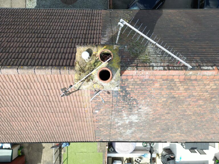
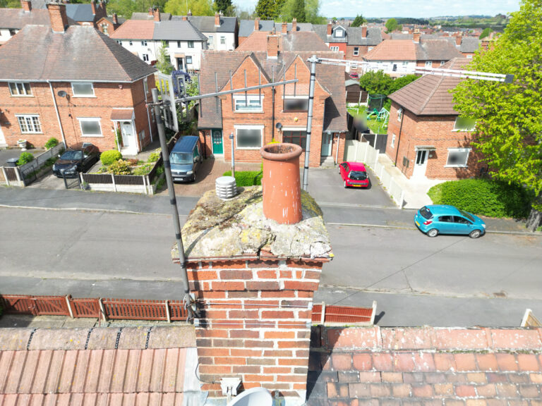
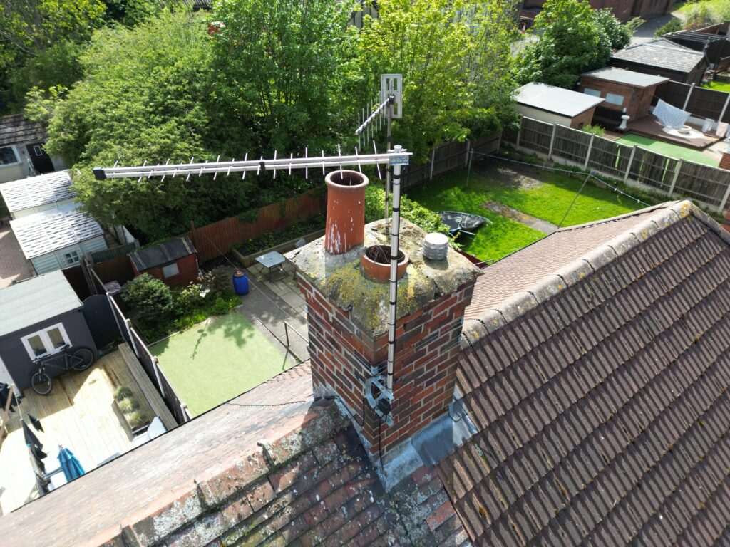
Stratos Drones would typically perform domestic roof surveys for our clients, with the aim of identifying any existing defects or underlying problems. A recent project involved an extensive roof inspection for a local family home. We used our drone to take numerous high-resolution images and video recordings of the property, which were then sent to the client to be provided to their roofing company to conduct the repairs.
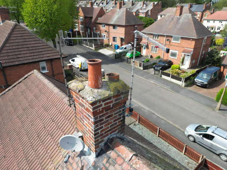
The analysis revealed that there was significant damage to the chimney stack, and the chimney pots, cracked mortar around the brickwork in particular.
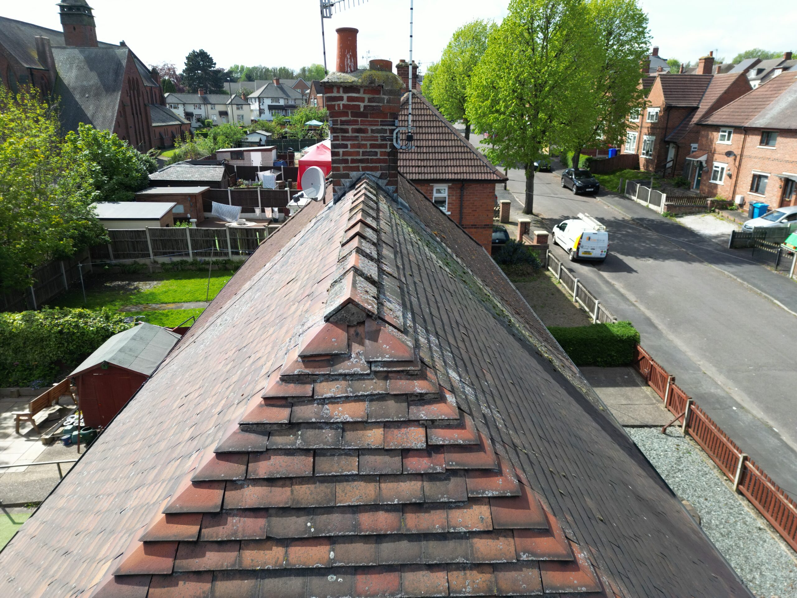
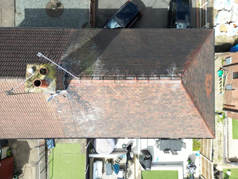
There were also a variety of defects identified with the mortar at the gable end of the property, highlighting the need to re-point and secure the tiles, preventing leaks and the possibility of birds nesting within the roof space.
Loose tiles were also identified, showing where they had slipped and needed to be secured.
Our drone survey enabled the client to detect these issues quickly, so they could arrange for a roofer to complete the repairs before any further damage occurred. Without our drone survey, this damage may have been left unnoticed until it was too late.
Conclusion
Drones are revolutionising the surveying sector, providing surveyors with the ability to collect data quickly, accurately, and safely. They are invaluable tools for both commercial and domestic customers, enabling surveyors to detect existing issues before they become serious problems.
At Stratos Drones we take great pride in our drone surveying services, providing our clients with high-quality results that enable them to make informed decisions about their properties. We look forward to continuing to revolutionise the surveying industry with our advanced drone technology.
If you are interested in finding out more about how Stratos Drones can help you with your roof or building surveys, please don’t hesitate to get in touch.
